Thursday, August 25, 2016
Thursday in the AWDE CPAC Testbed
The final day of participation for the AWDE CPAC in the testbed included valuable feedback from FAA meteorologists and an ATC specialist.
Thursday in the AWT
Forecaster reviewing radar mosaic imagery for issuance of convective products
Ceiling and visibility forecasters testing collaboration connecting national and local offices
Discussing how products are generated based on navigational points
Wednesday, August 24, 2016
Wednesday in the AWDE CPAC Testbed
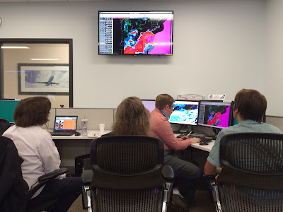
Wednesday in the AWDE CPAC included numerous participants with PERTI expertise. Valuable feedback was given while establishing communication with the AWT throughout the day.
Tuesday, August 23, 2016
Tuesday in the AWDE CPAC Testbed
Participants discussing long range experimental products. Participant backgrounds include TFM and ATC specialists, NWS Mt. Holly meteorologist, and pilots.
Week Two of the 2016 Summer Experiment at AWT
Experimenters working on cloud and visibility grids for the western United States
Experimental satellite products and one minute imagery being used to look at the current weather
Video conference established with the AWDE lab in Atlantic City
Monday, August 22, 2016
Thursday, August 18, 2016
Wednesday, August 17, 2016
Day Three in the Testbed
 |
| Participants in AWDE collaborate with AWT via NWS Chat and a live video feed |
Tuesday, August 16, 2016
Day Two in the Testbed
Tuesday in the AWDE CPAC included participants with TFM backgrounds as well as GA pilots. Feedback was given on the long range experimental products, C&V and TAF products, as well as CAWS and new versions of the CCFP.
2016 AWT Summer Experiment is Underway
The Aviation Weather Testbed's 2016 Summer Experiment started this week with participants from across the county. This summer's experiment includes a test of cloud and visibility grid collaboration, new AWIPS2 convective SIGMET production tools, and experimental guidance including new versions of the CCFP.
Monday, August 15, 2016
Week 1 of the 2016 Summer Experiment Kicks Off in the AWDE CPAC
The first day of the 2016 Summer Experiment kicked off with collaborative efforts between AWC and the AWDE CPAC, located at the William J. Hughes Technical Center in Atlantic City, NJ.
Tuesday, February 23, 2016
Tuesday in the Testbed
Experimenters looking at ceiling and visibility guidance
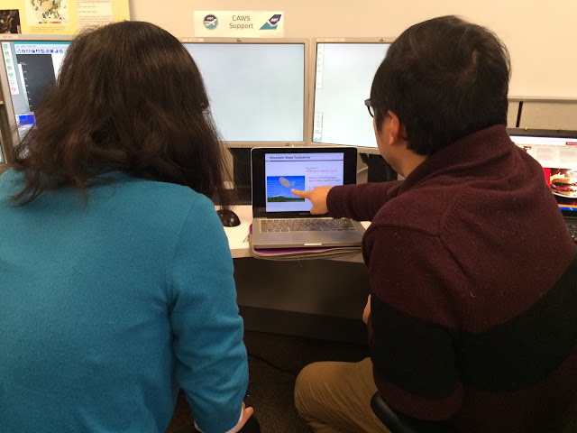
CAWS support desk engaged in discussion
Experimenter modifying tools for grid editing efficiency
Monday, February 22, 2016
Experimental CAWS 004 issued for low turb over southern CA
Collaborative Aviation Weather Statement 004
NWS Aviation Weather Center Kansas City MO
1919 UTC Mon 22 Feb 2016
Weather: Turbulence
Valid: 1919-0100Z
ARTCCs affected: ZLA
Terminals affected: KLAX, KPHX
SUMMARY: Moderate to severe turbulence expected over S CA thru 23Z
DISCUSSION: Moderate to severe turbulence with isolated severe pockets are expected over S ZLA thru 01Z. NE flow will contribute to a moderate Santa Ana wind event with low level turb expected below FL100.
A SIGMET is unlikely at this point, an additional CAWS is also unlikely.
BOUNDING BOX: 35.33,-125.28 38.43,-118.18 32.61,-110.69 29.29,-117.41 35.33,-125.28
Experimental CAWS 003 issued for icing over WI and MI
Collaborative Aviation Weather Statement 003
NWS Aviation Weather Center Kansas City MO
1735 UTC Mon 22 Feb 2016
Weather: Icing
Valid: 1800-2000Z
ARTCCs affected: ZAU, ZMP, ZOB
Terminals affected: KDTW, KMKE, KMDW, KORD
SUMMARY: Possible SEV icing over Great Lakes.
DISCUSSION: Moderate to occasional severe icing is expected over the Great Lakes with highest potential for severe from eastern WI, northern IL, and western Lower MI. This may impact arrivals/departures for KDTW, KMKE, KMDW, and KORD. A SIGMET is possible in the hatched area. Conditions will slowly shift east-northeastward into central lower MI and weaken after 20Z.
...Additional CAWS are not expected in this region...
BOUNDING BOX: 49.74,-95.84 48.65,-77.54 36.56,-80.29 37.06,-93.54 49.74,-95.84
Experimental CAWS 002 issued for turbulence over OH and PA
Collaborative Aviation Weather Statement 002
NWS Aviation Weather Center Kansas City MO
1644 UTC Mon 22 Feb 2016
Weather: Turbulence
Valid: 1800-2000Z
ARTCCs affected: ZAU, ZDC, ZID, ZKC, ZNY, ZOB
Terminals affected: KBWI, KDCA, KIAD, KMDW, KORD, KPHL
SUMMARY: MOD-SEV turbulence across Ohio Valley and Mid-Atlantic States through 20Z.
DISCUSSION: A zone of frequent moderate with occasional severe turbulence is expected across northern ZID-southern ZOB-southwestern ZNY-northern ZDC. A localized regions of severe potential exists from far northeastern ZID-southern ZOB-far northern ZDC-extreme southwestern ZNY.
Moderate turbulence is most likely from FL360-270 with severe possible from FL340-290. Conditions are moving eastward and are likely to continue over the Mid-Atlantic coastline after 20Z.
...Additional CAWS are likely in this region...
BOUNDING BOX: 46.07,-90.98 45.78,-71.34 33.34,-73.50 33.28,-89.89 46.07,-90.98
Experimental CAWS 001 issued for severe icing potential near Salt Lake City
Collaborative Aviation Weather Statement 001
NWS Aviation Weather Center Kansas City MO
1610 UTC Mon 22 Feb 2016
Weather: Icing
Valid: 1610-2000Z
ARTCCs affected: ZLC
Terminals affected: KSLC
SUMMARY: Severe icing potential near Salt Lake City.
DISCUSSION: Moderate to occasional severe icing is expected near Salt Lake City between FL100-160. Conditions will move slowly southeastward and improve by 20Z.
...Additional CAWS are not expected in this area....
BOUNDING BOX: 45.49,-118.81 45.98,-103.09 35.47,-103.33 34.71,-117.04 45.49,-118.81
Collaborative Aviation Weather Statement (CAWS) for turbulence and icing hazards
Impact-based Decision Support Services and Digital Aviation Services
Week 2 kicks off at the 2016 Winter Experiment
Friday, February 12, 2016
Wrapping Up Week One
Most focused on non-convective CAWS Friday, using a case study from the end of December
The clouds and visibility desk centered on the West Coast, which experienced shallow fog this morning
Thanks to all of our participants! Look for updates on week two of the 2016 Winter Experiment (February 22-26).
Thursday, February 11, 2016
Quiet Weather Thursday
Quiet weather over the contiguous 48 states today so just one non-convective CAWS was issued, for icing in the mid section of the country.
Wednesday, February 10, 2016
Wed 2/10/16 CAWS 001 corrected for ARTCC's affected
20160210 - 001 (TB) FINAL CCA
Collaborative Aviation Weather Statement 001
NWS Aviation Weather Center Kansas City MO
1655 UTC Wed 10 Feb 2016
Correction to CAWS 001 - 20160210
Weather: Turbulence
Valid: 1900-2300Z
ARTCCs affected: ZDV
Terminals affected: KDEN
SUMMARY: Moderate turbulence expected over KDEN.
DISCUSSION: Moderate turbulence expected over the KDEN terminal area FL180-080 with embd moderate to isolated sev FL270-FL220. Models indicate turbulence may continue past 2300z. Current AIRMET does not include this area but may be amended to include this area later today.
SIGMET criteria is not expected.
...Corrected ARTCCs affected...
BOUNDING BOX: 42.32,-112.00 42.70,-101.81 36.85,-100.56 36.55,-108.22 42.32,-112.00
Wed 2/10/16 17Z CAWS 001 issued for turb over Colorado
20160210 - 001 (TB) FINAL
Collaborative Aviation Weather Statement 001
NWS Aviation Weather Center Kansas City MO
1654 UTC Wed 10 Feb 2016
Weather: Turbulence
Valid: 1900-2300Z
ARTCCs affected: ZAB, ZDV, ZKC, ZLC
Terminals affected: KDEN
SUMMARY: Moderate turbulence expected over KDEN.
DISCUSSION: Moderate turbulence expected over the KDEN terminal area FL180-080 with embd moderate to isolated sev FL270-FL220. Models indicate turbulence may continue past 2300z. Current AIRMET does not include this area but may be amended to include this area later today.
SIGMET criteria is not expected.
BOUNDING BOX: 42.32,-112.00 42.70,-101.81 36.85,-100.56 36.55,-108.22 42.32,-112.00
Tue 2/9/16 1616Z CAWS 002 amended for graphic, text, and level
20160209 - 002 (TB) FINAL AAA
Collaborative Aviation Weather Statement 002
NWS Aviation Weather Center Kansas City MO
1616 UTC Tue 09 Feb 2016
Amendment to CAWS 002 - 20160209
Weather: Turbulence
Valid: 1616-2200Z
ARTCCs affected: ZBW, ZNY
Terminals affected:
SUMMARY: Moderate Turbulence over New England
DISCUSSION: Area of persistent Moderate Turbulence expected over New England between 170 and FL290 from 16Z-22Z. There is a good probability of ISOL-SEV Turbulence during this period, however no SIGMET anticipated.
Area Amended for graphic, text and level changes.
BOUNDING BOX: 47.25,-67.05 40.29,-67.01 38.72,-73.65 44.85,-73.83 47.25,-67.05
Tue 2/9/16 16Z CAWS 002 issued for high turb over New England
20160209 - 002 (TB) FINAL
Collaborative Aviation Weather Statement 002
NWS Aviation Weather Center Kansas City MO
1605 UTC Tue 09 Feb 2016
Weather: Turbulence
Valid: 1605-2200Z
ARTCCs affected: ZBW
Terminals affected:
SUMMARY: Moderate Turbulence over New England
DISCUSSION: Area of persistent Moderate Turbulence expected over New England between FL190-FL290 from 16Z-22Z. No SIGMET anticipated.
BOUNDING BOX: 46.77,-67.14 41.12,-67.06 39.54,-73.29 45.08,-73.48 46.77,-67.14
Tue 2/9/16 1538Z CAWS 001 Corrected for color and text
20160209 - 001 (TB) FINAL CCA
Collaborative Aviation Weather Statement 001
NWS Aviation Weather Center Kansas City MO
1538 UTC Tue 09 Feb 2016
Correction to CAWS 001 - 20160209
Weather: Turbulence
Valid: 1538-2300Z
ARTCCs affected: ZJX, ZMA
Terminals affected: KMCO, KJAX, KPIE, KSAV, KSFB
SUMMARY: MOD OCNL SEV TURB SERN GA AND FL.
DISCUSSION: Between 15Z-18Z Turbulence will initially be moderate to severe below 080 then becoming moderate after 19Z continuing through 23Z.
Surface wind gusts are possible to 35-40KTS which may result in low-level wind shear near buildings and/or obstructions.
Corrected for color and text.
BOUNDING BOX: 29.84,-85.18 25.97,-82.69 27.16,-78.23 32.93,-79.28 33.03,-81.53 29.84,-85.18
Tue 2/9/16 15Z CAWS 001 issued for low turb over Florida
20160209 - 001 (TB) FINAL
Collaborative Aviation Weather Statement 001
NWS Aviation Weather Center Kansas City MO
1457 UTC Tue 09 Feb 2016
Weather: Turbulence
Valid: 1500-2300Z
ARTCCs affected: ZJX, ZMA
Terminals affected: KMCO, KJAX, KPIE, KSAV, KSFB
SUMMARY: MOD OCNL SEV TURB SERN GA AND FL.
DISCUSSION: Between 15Z-18Z Turbulence will initially be moderate to severe below 080 then becoming moderate after 19Z continuing through 23Z.
Surface wind gusts are possible to 35-40KTS which may result in low-level wind shear near buildings and shrubbery.
BOUNDING BOX: 29.84,-85.18 25.97,-82.69 27.16,-78.23 32.93,-79.28 33.03,-81.53 29.84,-85.18
Subscribe to:
Posts (Atom)


